Object ID:
2007.11.3f
Title:
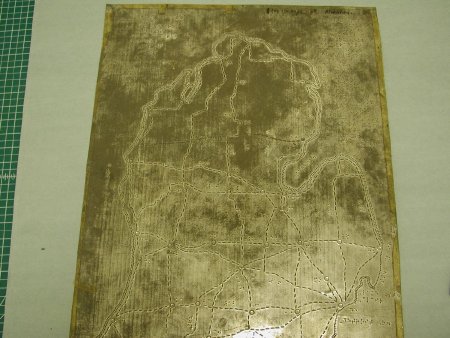
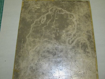
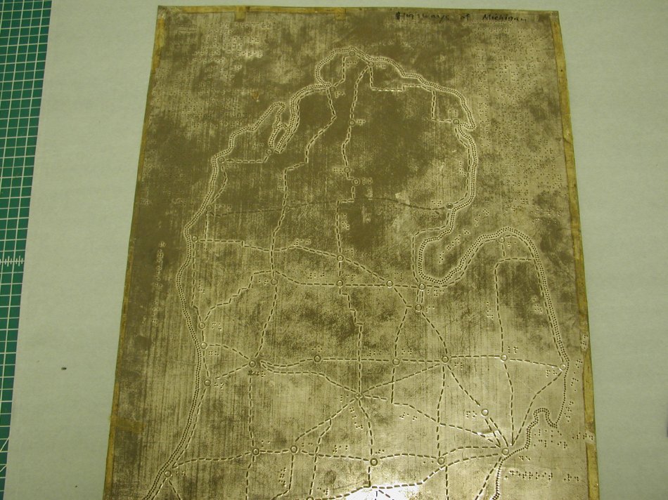
Highways of Michigan embossing plate
Description:
Plate for use in a printing press to emboss a tactile map of the highways of Michigan with raised lines and braille labeling. Also indicates rivers and city boundaries, with cities indicated by raised circles. Includes a map key. Title also written in black marker for press operator. Clear tape around edges. Three 1/8-inch holes, at top corners and center of plate, for securing plate in press. Braille and raised markings are both machine and hand-tooled.
Dimensions:
H-24 W-19 inches
Date:
ca. 1955
Made by:
[unknown]
Place of Origin:
[unknown]
Provenance:
Among a set of plates found in the APH plant. Source of plates and date received are not known. They do not appear to have been made at APH, based upon tooling and comparison to other APH map projects. Dating political features on the map of Africa and roads on the Michigan Highway Map suggest a date prior to 1960.
Credit Line:
APH Collection, 2007.11
Click to Enlarge
 Map Embossing Plate
 Map Embossing Plate
 Map Embossing Plate
 Map Embossing Plate