Object ID:
2004.2.1
Title:
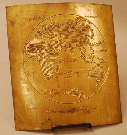
Map of Eastern Hemisphere embossing plate
Creator:
American Printing House for the Blind
Description:
Raised Line Map of Eastern Hemisphere with New York Point labeling.
Dimensions:
H-11.5 L-10.5 inches
Date:
[after 1892]
Made by:
American Printing House for the Blind
Place of Origin:
Louisville, KY
Provenance:
APH introduced its series of cardboard tactile maps in 1894. Captions were originally in New York Point, although some of the surviving plates indicate they were later converted to braille. The three volume set included eighty maps with the bulk covering the United States and its territories.
Click to Enlarge
 Embossing plate, Eastern Hemisphere
 Embossing plate, Eastern Hemisphere