Object ID:
1992.183
Title:
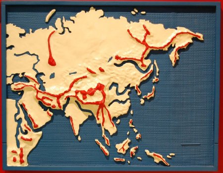
Asian simplified continental relief map
Description:
Kit contains color-coded, water-proof relief map; braille identification sheets, and cassettes. Water can be added inside railed areas of map. "Asian Simplified Continental Relief Map, Cassettes, Cat. No. 1-0142 . . . for ages 6 & up." --cover.
Dimensions:
H-26 W-20 D-2.5 inches
Date:
ca. 1984
Made by:
American Printing House for the Blind
Place of Origin:
Louisville, KY
Provenance:
APH introduced six continental map programs in 1984 to teach prominent physical geography and history of the six inhabited continents. The rails that enclosed the maps allowed them to be filled with water if desired. The three cassettes presented information at levels syitable for different grade levels. The maps had been discontinued by 1990.
Credit Line:
APH Collection, 1992.183.
Click to Enlarge
 Tactile map of Asia
 Tactile map of Asia