Object ID:
2010.25.1
Title:
Tactile map of the Far East, Southern Part
Creator:
American Foundation for Overseas Blind
Description:
Light green vacuum-formed plastic relief map, labeled in braille and raised letters; water denoted by raised horizontal lines, land is raised in exagerated relief with rivers represented by raised lines, cities by dots, and capitols by diamonds; braille symbols refer to accompanying key (not present with accession); braille grid labels on periphery; label in upper right, "FAR EAST/SOUTHERN PART/1:10,000,000/POUR NOS AVEUGLES/106 RUE DE LA POMPE/PARIS"; cast into lower right, "JS".
Dimensions:
H-15.5 W-19.5 D-0.5 inches
Date:
ca. 1950
Made by:
American Foundation for Overseas Blind
Place of Origin:
Paris, France
Provenance:
Found in the TVI resource room at W.T. Clarke High School in Westbury, NY during a spring cleaning project in 2010 by TVI Sheila Amato. The AFOB was originally founded in 1915 by George Kessler and Helen Keller in Paris, France as the Permanent Blind Relief War Fund for Soldiers and Sailors of the Allies. In 1925 it was renamed the American Braille Press for War & Civilian Blind. Shut down by the German occupation during WWII, it reemerged in 1946 as the AFOB. It became Helen Keller International in 1977.
Credit Line:
Gift of Dr. Sheila Amato, 2010.25.
Click to Enlarge
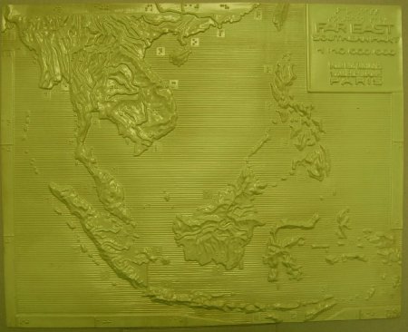 Tactile map of the far east
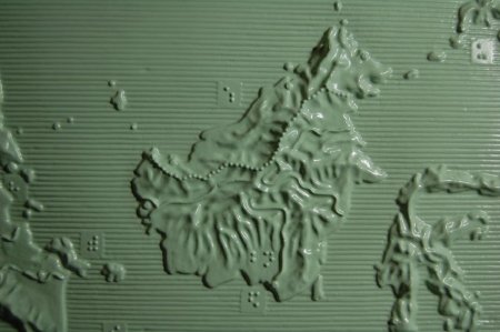 Detail, Island of Borneo
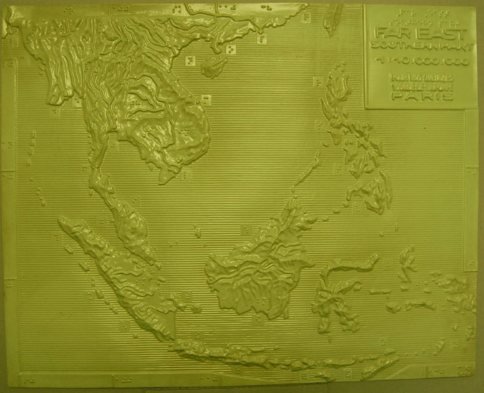 Tactile map of the far east
 Detail, Island of Borneo