Object ID:
1992.269
Title:
Relief Map of Africa
Creator:
American Printing House for the Blind
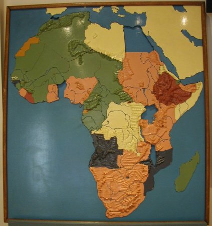
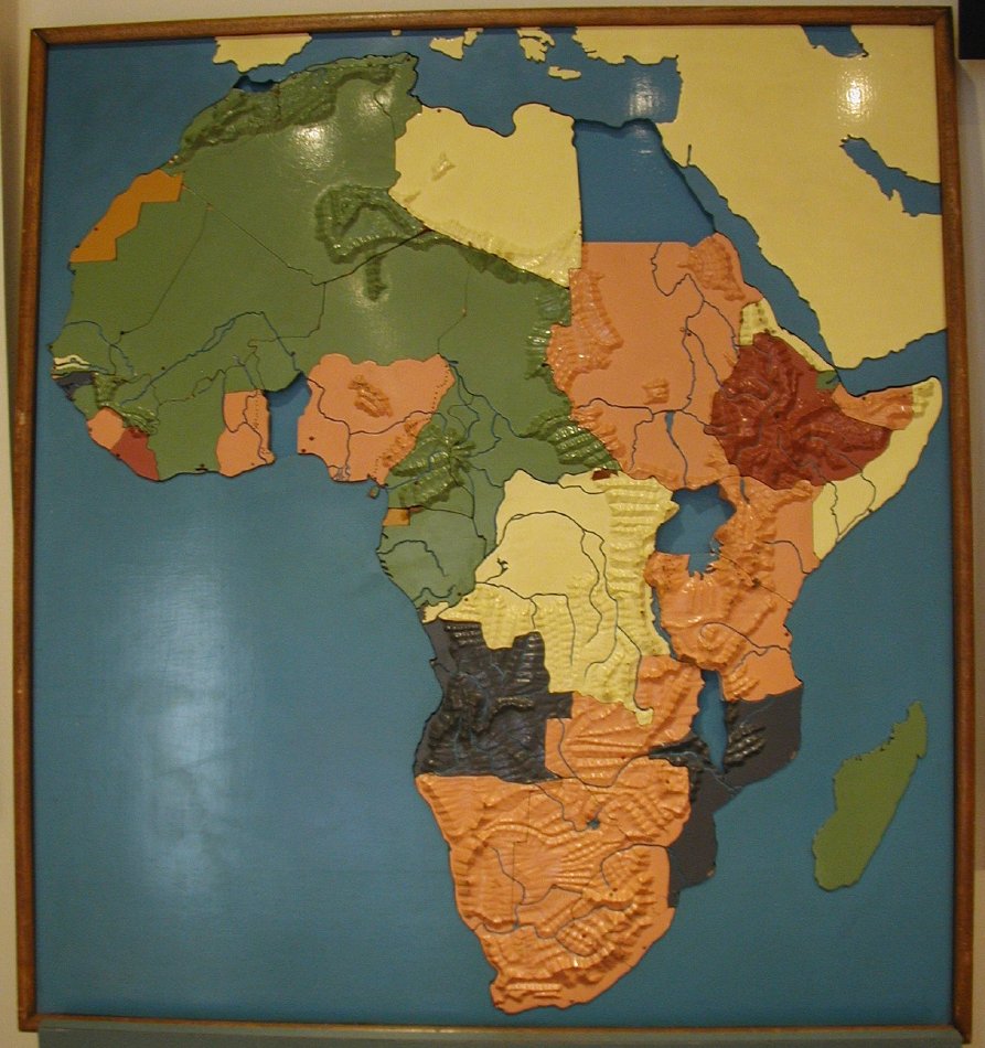
Description:
Carved wood relief map of Africa; painted and dissected; bodies of water are painted blue, rivers are recessed; mountains are carved in relief; countries are enameled pink, green, yellow, gray, red, and gold; principal cities indicated by nailheads, capitols are pointed and enameled red, others are rounded and enameled white; all pieces stamped on reverse, "#2"; reverse sides left unpainted; missing Spanish Morroco.
Dimensions:
H-47 W-38 D-4 inches
Date:
ca. 1940
Made by:
American Printing House for the Blind
Place of Origin:
Louisville, KY
Collection:
APH Collection
Provenance:
APH Superintendent Benjamin Huntoon began making wooden relief maps in the basement of the Ky. School for the Blind in the 1870s. The 1876 APH annual report described dissected maps produced at APH in partnership with John P. Morton & Company of Louisville. By 1921, large continental dissected relief maps were available, with a shellac finish. The style of map represented by 1992.269 was manufactured at APH beginning sometime in the middle 1930s. The political boundaries, primarily those of French West Africa, date the map between 1932 and 1945. The map's colors divide the map by colonial power, reinforcing the map's origins prior to WWII. British colonies are pink, French colonies are green, Portuguese colonies are gray, Spanish colonies are gold, Belgium and Italy are yellow. The countries which were never colonized, Egypt, Liberia and Ethiopia, are red. Note that this particular African map with its 1930s political borders was used to illustrate the entire product line as late as 1978 on product flyers.
Credit Line:
Gift of the Missouri School for the Blind, 1992.269.
Click to Enlarge
 Dissected Map of Africa
 Dissected Map of Africa