Object ID:
2013.15.2
Collection:
APH Collection
Creator:
Royal National Institute for the Blind
Title:
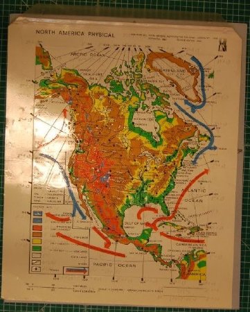
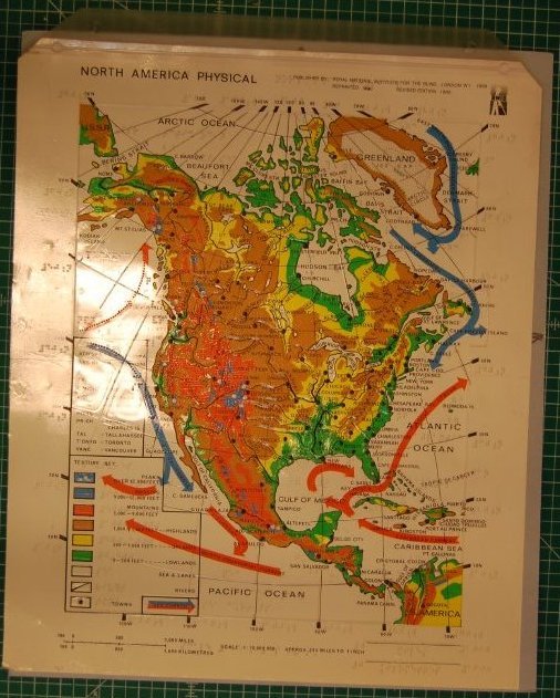
North American Physical map with tactile overlay
Date:
1990
Scope & Content:
Color map of North and Central America, printed on white plastic sheet; clear plastic overlay with captions in contracted braille hinged at top; map shows rivers, elevations are indicated on print map with colors, on tactile map with various textured pattersn; key in lower left.
Credit Line:
APH Collection, 2013.15.
Click to Enlarge
 Physical map of North America
 Physical map of North America