Object ID:
1998.80.105
Collection:
APH Collection
Creator:
unknown
Title:
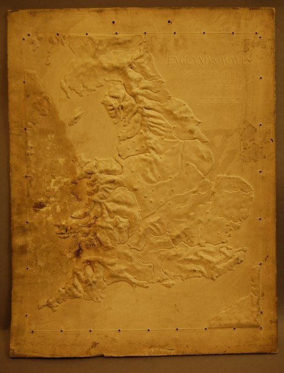
Relief map of England and Wales
Date:
n.d.
Scope & Content:
Relief map was produced on paper and mounted to a fiberboard; English title embossed in raised letters, upper right corner, and beneath this in braille; no labeling on mapped area; large water surfaces are smooth; rivers are depressed; landmasses are higher with mountainous areas prominent; scale of miles has braille numbers, upper right; latitude/longitude indicated by short raised lines with braille numbers at margins of map; raised square shapes indicate major cities; London is identified by a larger square.
Credit Line:
APH Collection, 1998.80
Click to Enlarge
 Relief map of England & Wales
 Relief map of England & Wales