Object ID:
1992.307
Title:
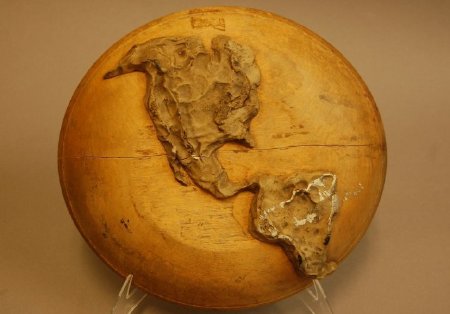
Hemisphere map of North & South America
Description:
The map was handmade, probably by a student or teacher, using a turned wooden bowl as the base; North and South American continents are made of a dried putty-like material, formed by hand, and permanently attached to the base.
Dimensions:
D-2.75 Dia-10.5 inches
Date:
n.d.
Place of Origin:
Louisville, KY
Collection:
KSB Collection
Provenance:
Found in storerooms at the Kentucky School for the Blind on Frankfort Avenue in Louisville, KY. Founded in 1842, KSB moved to its Frankfort Avenue location in 1855.
Credit Line:
Gift of the Kentucky School for the Blind, 1992.307
Click to Enlarge
 Relief map of the Americas
 Relief map of the Americas